Ministry of Public Works
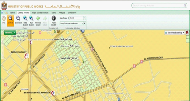
Enterprise GIS System for MOPW
Establish an enterprise GIS system using the Navteq Data with having a solution architecture based on COTS approach and web services access to the data.
Through designing and implementing an enterprise GIS system in MOPW, GISTEC helped the MOPW to contribute effectively in achieving a balanced sustainable development and provision of high quality of life for the people of UAE through outstanding corporate performance in the organizing, planning, construction and maintenance of infrastructure and federal housing projects in the cities and towns of the UAE according to the highest international standards based on qualified competence citizens. GISTEC has also supported MOPW in integrating the existing database with the proposed Navteq Data in order to update the database created by MOPW project team, this data is related to different projects and tasks handled by MOPW. GISTEC has provided MOPW with the latest GIS technology from Esri (ArcGIS Server 10) and from Latitude Geographics (Geocortex Essentials) in order to support housing and town planning studies and projects.