| Committee |
Abdelgadir Abuelgasim, Geography & Urban Planning Department, UAE University
 Dr. Abuelgasim received both his masters and PhD degrees from Boston University in 1996. Following he worked for one year as an assistant professor of remote sensing and surveying at Sultan Qabous University in Oman with the department of civil engineering. He later joined the NASA Goddard Space Flight Center in Maryland, USA in 1998 as a visiting scientist where he worked in a research program exploiting multi-angle remote sensing observations. In 2000 he relocated to Canada where he has been with the Canada Centre for Remote Sensing and the Canadian Space Agency as a research scientist. Dr Abuelgasim also served as the international geospatial data consultant during 2012 for the Nile Basin Initiative. Dr Abuelgasim research and teaching interests are focussed on the analysis of geospatial data for information products generation, physical and human geography and on the effects of human induced environmental and ecological changes. Dr. Abuelgasim received both his masters and PhD degrees from Boston University in 1996. Following he worked for one year as an assistant professor of remote sensing and surveying at Sultan Qabous University in Oman with the department of civil engineering. He later joined the NASA Goddard Space Flight Center in Maryland, USA in 1998 as a visiting scientist where he worked in a research program exploiting multi-angle remote sensing observations. In 2000 he relocated to Canada where he has been with the Canada Centre for Remote Sensing and the Canadian Space Agency as a research scientist. Dr Abuelgasim also served as the international geospatial data consultant during 2012 for the Nile Basin Initiative. Dr Abuelgasim research and teaching interests are focussed on the analysis of geospatial data for information products generation, physical and human geography and on the effects of human induced environmental and ecological changes.
|
Andreas Wytzisk, Geoinformatics & Computer Science, Bochum University of Applied Science
 I'm a Professor for Geoinformatics and Computer Science at the Bochum University for Applied Science (Hochschule Bochum) and Managing Director of the 52�North Initiative for Geospatial Open Source Software.
Before re-entering my academic career path I was a senior member of the con terra team with over 15 years experience working in the field of GIS and spatial data infrastructures.
For the last decade I have specialized on technical and organizational aspects of spatial data infrastructures and have delivered a number of key projects with this focus, whilst working with senior management to create vision and thought leadership. I'm highly experienced in international project management and coordination of heterogeneous working groups.
Holding a PhD in Geoinformatics, I worked as project manager for agricultural and environmental IT projects at pro_Plant GmbH for a number of years. I joined the Institute for Geoinformatics, M�nster as research associate and assistant professor, before transitioning into the International Institute for Geo-information Science and Earth Observation (ITC) in Enschede as assistant professor for SDI. In September 2006 I joined con terra as senior consultant for spatial data infrastructures and managing director for 52�North. Since April 2013 I hold a professorship at the University of Applied Science in Bochum.
Specialties: Spatial data infrastructures, geospatial innovations, sensor web enablement (SWE), OGC, INSPIRE I'm a Professor for Geoinformatics and Computer Science at the Bochum University for Applied Science (Hochschule Bochum) and Managing Director of the 52�North Initiative for Geospatial Open Source Software.
Before re-entering my academic career path I was a senior member of the con terra team with over 15 years experience working in the field of GIS and spatial data infrastructures.
For the last decade I have specialized on technical and organizational aspects of spatial data infrastructures and have delivered a number of key projects with this focus, whilst working with senior management to create vision and thought leadership. I'm highly experienced in international project management and coordination of heterogeneous working groups.
Holding a PhD in Geoinformatics, I worked as project manager for agricultural and environmental IT projects at pro_Plant GmbH for a number of years. I joined the Institute for Geoinformatics, M�nster as research associate and assistant professor, before transitioning into the International Institute for Geo-information Science and Earth Observation (ITC) in Enschede as assistant professor for SDI. In September 2006 I joined con terra as senior consultant for spatial data infrastructures and managing director for 52�North. Since April 2013 I hold a professorship at the University of Applied Science in Bochum.
Specialties: Spatial data infrastructures, geospatial innovations, sensor web enablement (SWE), OGC, INSPIRE
|
|
Issam Attalah - Conference Chair (TIEM/GISTEC)
 Issam Attalah, is the Business Partner Executive at GISTEC. Issam holds a Master’s Degree in Information and Communication Sciences and he is currently preparing his PhD. Issam Attalah, is the Business Partner Executive at GISTEC. Issam holds a Master’s Degree in Information and Communication Sciences and he is currently preparing his PhD.
With strong background in education, training, corporate communications and events, Issam is leading the education program at GISTEC. He is looking after the implementation of GISTEC’s CSR program. Part of his current job assignments is to bridge between GIS industry and academia.
|
Laszl� Zentai, Department of Cartography and Geoinformatics , E�tv�s Lor�nd University/ International Cartographic Association (ICA)
 I was interested in maps since my childhood, so my path into cartography was natural. Now I am Professor and Head of the Department of Cartography and Geoinformatics at the E�tv�s Lor�nd University in Budapest. I specialise in teaching computer cartography, topographic maps and relief representation. I am a member and currently President of the Hungarian National Committee for ICA. My major international ICA activities included organization of three joint ICA Commissions' meetings in 1993, 2005 and 2011, and the Executive Committee meeting in Budapest in 2003. I am a member of the ICA Commission on Education and Training since 1999, a former Chair (2003-2007) and Vice Chair (2007-2011). I am an active orienteer and serve on the International Orienteering Federation's Council. I was interested in maps since my childhood, so my path into cartography was natural. Now I am Professor and Head of the Department of Cartography and Geoinformatics at the E�tv�s Lor�nd University in Budapest. I specialise in teaching computer cartography, topographic maps and relief representation. I am a member and currently President of the Hungarian National Committee for ICA. My major international ICA activities included organization of three joint ICA Commissions' meetings in 1993, 2005 and 2011, and the Executive Committee meeting in Budapest in 2003. I am a member of the ICA Commission on Education and Training since 1999, a former Chair (2003-2007) and Vice Chair (2007-2011). I am an active orienteer and serve on the International Orienteering Federation's Council.
|
Michael Batty, Centre for Advanced Spatial Analysis (CASA), University College London
 Michael Batty is Bartlett Professor of Planning at University College London where he is Chairman of the Centre for Advanced Spatial Analysis (CASA). His most recent books are Cities and Complexity (MIT Press, 2007) for which he received the Alonso Prize of the Regional Science Association in 2011, Virtual Geographic Environments (edited with Hui Lin, ESRI Press, 2011), Agent-Based Models of Geographical Systems (edited with A Heppenstall et al., Springer 2012). He is editor of the journal Environment and Planning B. He was elected a Fellow of the British Academy in 2001 and the Royal Society in 2009, and awarded a CBE in the Queen's Birthday Honours in 2004 for 'services to geography'. Michael Batty is Bartlett Professor of Planning at University College London where he is Chairman of the Centre for Advanced Spatial Analysis (CASA). His most recent books are Cities and Complexity (MIT Press, 2007) for which he received the Alonso Prize of the Regional Science Association in 2011, Virtual Geographic Environments (edited with Hui Lin, ESRI Press, 2011), Agent-Based Models of Geographical Systems (edited with A Heppenstall et al., Springer 2012). He is editor of the journal Environment and Planning B. He was elected a Fellow of the British Academy in 2001 and the Royal Society in 2009, and awarded a CBE in the Queen's Birthday Honours in 2004 for 'services to geography'.
|
Mei-Po Kwan, Department of Geography & GIScience (GGIS), University of Illinois
 Mei-Po Kwan is Professor of Geography and Geographic Information Science at the University of Illinois at Urbana-Champaign. She received the 2005 UCGIS Research Award for outstanding contributions to GIScience from the University Consortium for Geographic Information Science (UCGIS). In 2011, she received a Distinguished Scholarship Honors award from the Association of American Geographers (AAG). Kwan is currently Editor of the Annals of the Association of American Geographers and the book series entitled “SAGE Advances in Geographic Information Science and Technology.” She was General Chair of the 7th International Conference on Geographic Information Science. Kwan has received grants as PI or co-PI totaling about US$20 million from the U.S. National Science Foundation, the U.S. National Institutes of Health, and the U.S. National Center for Geographic Information and Analysis (NCGIA). She has made outstanding contributions to geographic information science and geography, especially in developing geocomputational algorithms for implementing space-time accessibility measures that are sensitive to individual differences, 3D interactive geovisualization, network-based 3D topological data models, GIS-based intelligent emergency response systems (GIERS), the protection of geoprivacy through geographical masks, and computational-process modeling of activity-travel decisions. Mei-Po Kwan is Professor of Geography and Geographic Information Science at the University of Illinois at Urbana-Champaign. She received the 2005 UCGIS Research Award for outstanding contributions to GIScience from the University Consortium for Geographic Information Science (UCGIS). In 2011, she received a Distinguished Scholarship Honors award from the Association of American Geographers (AAG). Kwan is currently Editor of the Annals of the Association of American Geographers and the book series entitled “SAGE Advances in Geographic Information Science and Technology.” She was General Chair of the 7th International Conference on Geographic Information Science. Kwan has received grants as PI or co-PI totaling about US$20 million from the U.S. National Science Foundation, the U.S. National Institutes of Health, and the U.S. National Center for Geographic Information and Analysis (NCGIA). She has made outstanding contributions to geographic information science and geography, especially in developing geocomputational algorithms for implementing space-time accessibility measures that are sensitive to individual differences, 3D interactive geovisualization, network-based 3D topological data models, GIS-based intelligent emergency response systems (GIERS), the protection of geoprivacy through geographical masks, and computational-process modeling of activity-travel decisions.
|
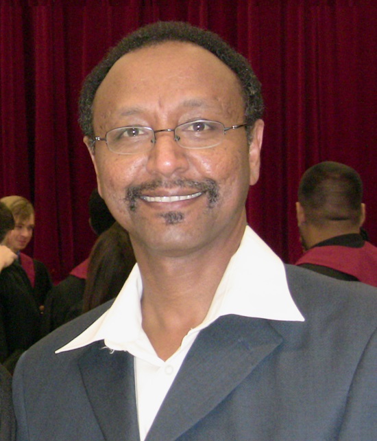
Mohamed R. Bualhamam, Department of Geography & Urban Planning, UAE University
 Mohamed Rashed Bualhamam received the Ph. D. in Environmental Dynamics and GIS from the University of Arkansas. He is a Professor in the Geography and Urban Planning Department at the UAE University His research interests in: GIS in Education, GIS for Project Management, and Environmental Applications of GIS. He has published many papers in journals, books and conference proceedings and participated conferences and research projects on these topics. He was appointed at the government of RAK as a Deputy General Manager for Technical Affairs of Ras al Khaimah Municipality. He also, superintendent for the following administrations in RAK (Town Planning and Survey Administration, Building and Engineering Administration, and Health and Environment Administration).. Mohamed Rashed Bualhamam received the Ph. D. in Environmental Dynamics and GIS from the University of Arkansas. He is a Professor in the Geography and Urban Planning Department at the UAE University His research interests in: GIS in Education, GIS for Project Management, and Environmental Applications of GIS. He has published many papers in journals, books and conference proceedings and participated conferences and research projects on these topics. He was appointed at the government of RAK as a Deputy General Manager for Technical Affairs of Ras al Khaimah Municipality. He also, superintendent for the following administrations in RAK (Town Planning and Survey Administration, Building and Engineering Administration, and Health and Environment Administration)..
|
Mohammad Ghanim, Department of Civil Engineering, American University in Dubai
 Dr. Mohammad Ghanim (Ph.D., PE) is an Assistant Professor of Civil Engineering at the American University in Dubai. He holds both Ph.D. and M.Sc. degrees in Civil Engineering from Michigan State University and a B.Sc. degree in civil engineering from An-Najah National University, in Nablus, Palestine (2003). His area of expertise is in traffic engineering, with emphasis on traffic network modeling, traffic demand forecasting, and transportation planning. Dr. Mohammad Ghanim (Ph.D., PE) is an Assistant Professor of Civil Engineering at the American University in Dubai. He holds both Ph.D. and M.Sc. degrees in Civil Engineering from Michigan State University and a B.Sc. degree in civil engineering from An-Najah National University, in Nablus, Palestine (2003). His area of expertise is in traffic engineering, with emphasis on traffic network modeling, traffic demand forecasting, and transportation planning.
|
|
Paul Longley, Department of Geography, University College London
 Prof. Paul Longley (B.Sc., Ph.D., D.Sc., AcSS) is Professor of Geographic Information Science at University College London, UK. His publications include 14 books and more than 125 refereed journal articles and contributions to edited collections. He has held over 40 research grants and has supervised more than 35 Ph.D. students (most funded by research councils). He is a co-editor of the journal Environment and Planning B and a member of five other editorial boards. He has held ten externally-funded visiting appointments and given over 150 conference presentations and external seminars. He teaches Geographic Information Systems and Science and is a co-author of the best-selling book of that name. Prof. Paul Longley (B.Sc., Ph.D., D.Sc., AcSS) is Professor of Geographic Information Science at University College London, UK. His publications include 14 books and more than 125 refereed journal articles and contributions to edited collections. He has held over 40 research grants and has supervised more than 35 Ph.D. students (most funded by research councils). He is a co-editor of the journal Environment and Planning B and a member of five other editorial boards. He has held ten externally-funded visiting appointments and given over 150 conference presentations and external seminars. He teaches Geographic Information Systems and Science and is a co-author of the best-selling book of that name.
|
Peiman Kianmehr, Department of Civil Engineering, American University in Dubai
 Dr. Kianmehr's expertise is in water and environmental engineering, with emphasis on water & wastewater treatment and environmental chemistry. His research work involves physical, biochemical and biological characterization of waste activated sludge to identify pretreatment impacts. Prior to joining AUD, he worked with Environment Canada on the design, operation and evaluation of aerobic and anaerobic reactors as well as pretreatment (ozonation and sonication) reactors. Between 1999 and 2004, he directed various design, planning, and QC studies in the field of hydraulic engineering, and worked on major water transmission and supply projects, as well as earth dam construction and flood control projects. Dr. Kianmehr's expertise is in water and environmental engineering, with emphasis on water & wastewater treatment and environmental chemistry. His research work involves physical, biochemical and biological characterization of waste activated sludge to identify pretreatment impacts. Prior to joining AUD, he worked with Environment Canada on the design, operation and evaluation of aerobic and anaerobic reactors as well as pretreatment (ozonation and sonication) reactors. Between 1999 and 2004, he directed various design, planning, and QC studies in the field of hydraulic engineering, and worked on major water transmission and supply projects, as well as earth dam construction and flood control projects.
|
Seth Spielman, Geography department (Human Geography & GIScience), University of Colorado
 I am a human geographer and Geographic Information Scientist. My research uses new forms of data and innovative computational tools to study micro-scale variations in behavior, health, and well-being within American cities. I'm currently an Assistant Professor in the Geography Department of the University of Colorado at Boulder where I direct of the spatial sciences node of the NSF-Census Research Network. Since arriving at Colorado in 2010 I have secured over $1.7M in external research support (as PI) from the National Science Foundation, The National Institutes of Health, and the Department of Energy. My work has recently been profiled in Science and other outlets. Prior to joining the faculty at Colorado I was the Associate Director of the S4 Initiative at Brown University. In 2008 I completed a National Science Foundation IGERT Fellowship in Geographic Information Science at the National Center for Geographic Information and Analysis in the Geography Department at State University of New York at Buffalo. From 1999-2006 I was at the Columbia University Graduate School of Architecture, Planning and Preservation, first as a masters student and later as an Adjunct Assistant Professor and Adjunct Associate Research Scientist. Once upon a time I was the owner of an antiquarian bookshop in the Flatiron Building in New York City. I'm also a dad, a fisherman, a bird-watcher, a really good snowboarder, and a bike commuter. I am a human geographer and Geographic Information Scientist. My research uses new forms of data and innovative computational tools to study micro-scale variations in behavior, health, and well-being within American cities. I'm currently an Assistant Professor in the Geography Department of the University of Colorado at Boulder where I direct of the spatial sciences node of the NSF-Census Research Network. Since arriving at Colorado in 2010 I have secured over $1.7M in external research support (as PI) from the National Science Foundation, The National Institutes of Health, and the Department of Energy. My work has recently been profiled in Science and other outlets. Prior to joining the faculty at Colorado I was the Associate Director of the S4 Initiative at Brown University. In 2008 I completed a National Science Foundation IGERT Fellowship in Geographic Information Science at the National Center for Geographic Information and Analysis in the Geography Department at State University of New York at Buffalo. From 1999-2006 I was at the Columbia University Graduate School of Architecture, Planning and Preservation, first as a masters student and later as an Adjunct Assistant Professor and Adjunct Associate Research Scientist. Once upon a time I was the owner of an antiquarian bookshop in the Flatiron Building in New York City. I'm also a dad, a fisherman, a bird-watcher, a really good snowboarder, and a bike commuter.
|
|
|
Young-ji Byon, Department of Civil Infrastructure and Environmental Engineering, Khalifa University
 Young-Ji Byon received his BASc (2003), MASc (2005) and PhD (2011) from the University of Toronto, Canada. Since January 2012, Young-Ji is an Assistant Professor in the Department of Civil Infrastructure and Environmental Engineering, Khalifa University of Science, Technology and Research (KUSTAR), Abu Dhabi, UAE. In KUSTAR, He is teaching courses related to civil engineering. Young-Ji has worked as a lecturer at the University of Toronto, as a postdoctoral research fellow at the University of Chile and the University of Calgary. He has multiple publications in the field of transportation engineering related to GIS, GPS, Data Fusion and Traffic Monitoring. Young-Ji Byon received his BASc (2003), MASc (2005) and PhD (2011) from the University of Toronto, Canada. Since January 2012, Young-Ji is an Assistant Professor in the Department of Civil Infrastructure and Environmental Engineering, Khalifa University of Science, Technology and Research (KUSTAR), Abu Dhabi, UAE. In KUSTAR, He is teaching courses related to civil engineering. Young-Ji has worked as a lecturer at the University of Toronto, as a postdoctoral research fellow at the University of Chile and the University of Calgary. He has multiple publications in the field of transportation engineering related to GIS, GPS, Data Fusion and Traffic Monitoring.
|
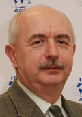
 Georg Gartner (born 1966) is a Professor for Cartography and Geo-Mediatechniques at the Research Group of Cartography at the Vienna University of Technology. He holds graduate qualifications in geography and cartography from the University of Vienna and the Vienna University of Technology. He is the president of the
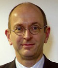
  Dr. Mansoor is a Professor of computer engineering at the American university in Dubai. He is the director of the centre of the research and education in smart technologies (CREST) at the university. He has a Ph.D. in computer engineering from Aston University in 1990. He has an excellent experience in organizing international conferences and workshops.