Enterprise GIS
An enterprise GIS provides broad access to geospatial data and applications throughout the organization. It is a platform for delivering organization-wide geospatial capabilities while improving access to geographic information and extending geospatial capabilities to nontraditional users of GIS.
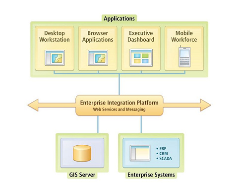 Enterprise GIS enhances the capabilities of other enterprise systems (such as CRM, ERP, etc.) by geo-spatially enabling them with spatial analysis capabilities. It increases the overall operating efficiency through the more effective and consistent use of geo-spatial data across an organization.
Enterprise GIS enhances the capabilities of other enterprise systems (such as CRM, ERP, etc.) by geo-spatially enabling them with spatial analysis capabilities. It increases the overall operating efficiency through the more effective and consistent use of geo-spatial data across an organization.